Tornado Touchdown: Severe Weather Possible Across the Northern Great Plains, Coastal Texas, and Louisiana
Severe weather conditions are expected to develop across multiple regions, including the northern Great Plains, the coastal region of Texas, and much of Louisiana. These areas are bracing for a combination of strong thunderstorms, possible tornadoes, heavy rainfall, and the threat of flash flooding. Residents and travelers are urged to stay informed and prepared as conditions evolve throughout the day.
The northern Great Plains are set to experience active weather, with thunderstorms that are likely to produce strong winds and small hail. These storms are expected to intensify later today, as atmospheric conditions become more conducive to severe weather development. Wind gusts in these areas could reach up to 60 miles per hour, potentially causing damage to trees, power lines, and unsecured structures. While hail may be smaller in size, it can still pose a significant risk to crops, vehicles, and other exposed surfaces.
The primary concern, however, is the potential for tornadoes. Tornadoes can form unexpectedly within supercells, which are powerful thunderstorms capable of producing rotating updrafts. These storms could develop quickly in the northern Great Plains, where the environment will be favorable for tornado formation. Residents in these areas should remain on high alert and have an emergency plan in place. Tornadoes, even brief ones, can cause significant damage, especially if they strike with little warning.
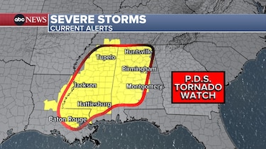
To the south, in Texas, a low-pressure system has formed near the coast, bringing the possibility of heavy rain and isolated supercells. This system is expected to intensify, creating favorable conditions for thunderstorms that could lead to more severe weather. The combination of heavy rainfall and ongoing storm activity may exacerbate the threat of flooding in already saturated areas. Areas that have experienced recent rain will be particularly vulnerable, as swollen rivers and streams could flood again with the additional rainfall. Flash floods could occur rapidly, making it crucial for residents to remain cautious, particularly in low-lying areas and regions prone to water accumulation.
Within these thunderstorms, isolated supercells could develop, creating conditions conducive to tornado formation. These supercells are likely to be capable of producing brief, localized tornadoes, which can cause destruction even in the absence of larger storms. Tornadoes associated with these systems are often difficult to predict, so it is essential for residents in Texas and Louisiana to remain vigilant. Tornado warnings may be issued at short notice, so having access to real-time weather alerts and a safe place to shelter is vital.
As the system moves eastward into Louisiana, the risk of severe weather will continue, with heavy rain, thunderstorms, and the potential for tornadoes extending across the region. Louisiana residents should monitor their local weather stations closely, as flash flooding remains a significant concern. Low-lying areas near rivers, bayous, and coastal regions are especially at risk for inundation. Those living in areas prone to flooding should be prepared to evacuate or take shelter quickly if necessary.
In conclusion, the severe weather event unfolding today will bring significant challenges across the northern Great Plains, coastal Texas, and Louisiana. The combination of strong winds, hail, heavy rain, and tornado potential means residents in these regions must stay alert. By keeping informed through weather services, having an emergency plan, and preparing for possible evacuations or sheltering, people can reduce their risk and stay safe during this volatile w
eather event.